Publications

OSS
978-9973-856-53-1
2011

The study of hydrogeological risks of the Iullemeden Aquifer System (IAS) shared by Mali, Niger and Nigeria powered the countries with essential assets for coordinated and concerted water resource management. This action strengthens their capacities and provides to them available common tools: a Database, a Geographic Information System and a Mathematical Model. Countries have adopted the creation and establishment of a consultation mechanism to sustain the achievements and work towards integrated, coordinated and sustainable SAI water resources.

After updating knowledge of the system, it is necessary to establish a monitoring network of aquifers. However, there is still no reference piezometric network across the entire basin that can monitor and assess water resources in term of quantity and quality, to alert the decision makers to control and mitigate transboundary risks or impacts on their common resources.

This paper is a methodological guideline for officials responsible assigned for managing water resources to implement network(s) for monitoring and assessment of transboundary aquifers of the IAS that will strengthen cooperation between riparian countries jointly exploiting the resource.

It is strongly inspired by the methodology developed by the European Economic Commission (EEC) on strategies for monitoring and evaluation of transboundary groundwater. It also draws on experiences and lessons learned from the study lead by OSS on the North Western Sahara Aquifer System shared by Algeria, Libya and Tunisia. The approach and steps to monitor and evaluate groundwater aquifers is widely developed.

GICRESAIT
Monitoring & Evaluation of Transboundary Aquifers
Water Resources Management
Studies & Reports
OSS
978-9973-856-49-4
2011

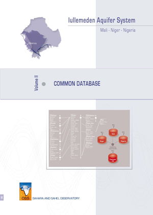
The establishment of the database (DB) of the IAS has allowed gathering and homogenizing all the available information on this basin in a consistent relational structure. This architecture facilitated the set of handlings, queries and thematic maps that this project could occur.

The system developed during the project, which focuses on the links Database-GIS-Model was very useful and gives countries a basis for developing effective management tools. This system is more efficient in short time compared with the time needed, just a few years ago, updating a model after a change in mesh, the integration of new data or the incorporation of a new scenario on water abstraction.

Regarding to the content of the Databases, considerable progress has been made, but the anomalies and shortcomings should be corrected with the national teams.

In order to climb to a higher level of reliability and to ensure the quality of the data, it is necessary to work more on the data collected and to define clear procedures for collecting new data.

The first task can be achieved by the countries themselves using the available tools and resources provided by the project. Regarding to the future updates, they will be reliable only if the procedures for collecting, coding and control are carried out at national level. Decentralization of management and handlings resources should be expected and encouraged to facilitate future updates and regular data.

GICRESAIT
Common Database
Water Resources Management
Studies & Reports
OSS
978-9973-856-85-2
2014

The North-Western Sahara Aquifer System (SASS) is a basin of over 1,000,000 km2 shared by three countries (Algeria, Tunisia, Libya) whose water reserves are substantial with an almost fossilized aspect.

Previous studies on the SASS had focused on the characteristics and operation of the aquifer as well as the evolution of abstractions, but rarely on the valuation of the water. Phase III of the SASS project aims to restore this equilibrum by promoting the sustainable management of water resources which is the most limiting factor to any stable economic activity.

This study related to socioeconomic aspects of irrigation represents one of the two main components of the SASS III project. It aims to enrich the achievements of the hydrogeological knowledge of water resources through socio-economic and environmental data. It analyzes the operation of farms and especially the actual behavior of the irrigators with particular emphasis on ability to adapt to the challenges that threaten the sustainability of the development.

The analysis of surveys done on 3,000 farmers helped identify the main constraints to water productivity, but also to quantify the scope of their economic impact and to make recommendations to enhance the value of the resource.

SASS
Socio-economic aspects
Water Resources Management
Studies & Reports
OSS
9973-856-00-7
2004

Serving as a driving and facilitating force, OSS, in carrying out the SASS Programme, relies first and foremost on the expertise available in specialised, well experienced institutions of the three countries as well as on broad international partnership.

The North-Western Sahara Aquifer System, (NWSAS), shared by Algeria, Tunisia and Libya, has considerable water reserves that cannot be totally exploited and are only very partially renewed. The NWSAS area over a million km2 and is composed of two major aquifers layers, the Continental Intercalary and the Terminal Complex. Over the last thirty years, abstraction by drilling has risen from 0.6 to 2.5 billion m3/yr. This rate of abstraction involves many risks: strong impact on neighbouring countries, salinisation, elimination of artesianism, drying up of outlets, etc. Simulations on the NWSAS Model have enabled OSS to pinpoint the location of the most vulnerable areas and map the risks facing the aquifer system. The three countries concerned by the future of the NWSAS will need to work together to develop a joint management system for the basin. A consultation mechanism needs to be instituted and gradually put into operation.

The present report is part of a set of three volumes which sum up the scientific activity of the project "North-Western Sahara Aquifer System" (SASS/OSS). It present the physiographic and hydrogeological data which have been taken into consideration in developing the digital model that simulates the hydrodynamic behaviour of the Saharan aquifers.

The present report presents respectively:

the aquifer formations of the North-Western Sahara and their schematisation with a view to their hydrogeological modelling;
the various hydrogeological characteristics of the aquifers of this system through an analysis that is focused on hydraulic exchanges and the impact of the exploitation on piezometry and on water salinity;
the chemical quality of the water and its isotopic characteristics allowing a better understanding of the hydrodynamic operating of the system.

SASS
Hydrogeology
Water Resources Management
Studies & Reports
OSS
9773-856-01-5
2004

Serving as a driving and facilitating force, OSS, in carrying out the SASS Programme, relies first and foremost on the expertise available in specialised, well experienced institutions of the three countries as well as on broad international partnership. The North-Western Sahara Aquifer System, (NWSAS), shared by Algeria, Tunisia and Libya, has considerable water reserves that cannot be totally exploited and are only very partially renewed. The NWSAS area over a million km2 and is composed of two major aquifers layers, the Continental Intercalary and the Terminal Complex. Over the last thirty years, abstraction by drilling has risen from 0.6 to 2.5 billion m3/yr. This rate of abstraction involves many risks: strong impact on neighbouring countries, salinisation, elimination of artesianism, drying up of outlets, etc. Simulations on the NWSAS Model have enabled OSS to pinpoint the location of the most vulnerable areas and map the risks facing the aquifer system. The three countries concerned by the future of the NWSAS will need to work together to develop a joint management system for the basin. A consultation mechanism needs to be instituted and gradually put into operation. The present report relates to the "Data Base & Geographic Information System". It summarizes the various reports drafted for the phases of this action. It is composed of two main parts: the first part presents the architecture of this data base and of the software products made during the project ; the second part gives a detailed description of the data collected, both by the national teams of the countries and by the permanent SASS team.

SASS
Data Base and GIS
Water Resources Management
Studies & Reports
OSS
9773-856-02-3
2004

Serving as a driving and facilitating force, OSS, in carrying out the SASS Programme, relies first and foremost on the expertise available in specialised, well experienced institutions of the three countries as well as on broad international partnership.

The North-Western Sahara Aquifer System, (NWSAS), shared by Algeria, Tunisia and Libya, has considerable water reserves that cannot be totally exploited and are only very partially renewed. The NWSAS area over a million km2 and is composed of two major aquifers layers, the Continental Intercalary and the Terminal Complex. Over the last thirty years, abstraction by drilling has risen from 0.6 to 2.5 billion m3/yr. This rate of abstraction involves many risks: strong impact on neighbouring countries, salinisation, elimination of artesianism, drying up of outlets, etc. Simulations on the NWSAS Model have enabled OSS to pinpoint the location of the most vulnerable areas and map the risks facing the aquifer system. The three countries concerned by the future of the NWSAS will need to work together to develop a joint management system for the basin. A consultation mechanism needs to be instituted and gradually put into operation.

This final report gives an account of all the works conducted in the framework of NWSAS project, between January 2000 and June 2002, for the design of a mathematical model of the North-Western Sahara Aquifer System.

This document is organized in three parts:

One first part called: Characterization of the Aquifer System and Conceptual Model, namely including the geological, hydrological and hydro-dynamic characterization of the basin,
The second part is called: Design of the Mathematical Model, describing the construction and calibration phases of the model in steady and transient states,
The third part is devoted to the Execution of Predictive Simulations. This part successively develop: the definition and execution of exploratory simulations, the construction of a NWSAS miniature model to investigate the reservoir, the definition and performing of predictive simulations.

SASS
Mathematical model
Water Resources Management
Studies & Reports
OSS
978-9973-856-86-9
2014

The North-Western Sahara Aquifer System (SASS) is a basin of over 1,000,000 km2 shared by three countries (Algeria, Tunisia, Libya) whose water reserves are substantial with an almost fossilized aspect. The implementation of “Agricultural Demonstration Pilots” within the framework of the SASS III project was intended to demonstrate within a participatory approach, the feasibility, effectiveness and efficiency of technical solutions to local problems of unsustainability management and operation of the SASS resource in irrigation in the three countries sharing the resource.

Six agricultural demonstration pilots at farm scale level, with different themes, were implemented by farmers themselves in the three countries. The technical innovations introduced aimed at the intensification of cropping systems, water saving and the improvement of the resource’s valorization through the selection of high added value crops.

The results obtained after two crops in the three countries help confirm the availability of efficient technical solutions for the renovation of cropping systems and making them viable at farm level. What remains to be done, however, is validating these results and making them reliable on a larger spatial scale in pilot “production systems” integrating the various local structural constraints to the development of irrigation in the SASS area.

SASS
Agricultural demonstration pilots
Water Resources Management
Studies & Reports
OSS
978-9973-856-97-5
2017

The BRICKS project has been designed to facilitate the fulἀllment of these needs. In fact, the project provides a regional platform to spur exchanges with a view to conducting common actions among the 12 Sahel and West African countries of the SAWAP program. The common objective is to improve countries access to best practices and monitoring information in terms of sustainable land use and management in SAWAP portfolio.

Elaborated within the framework of the BRICKS project, the present guide represents a common core for the implementation of the monitoring and evautaion system of the SAWAP portfolio. It aims to consolidate and support the different monitoring and evaluation systems of the national projects.

BRICKS
Guide for the monitoring-evaluation
Environmental Monitoring & Biodiversity
Studies & Reports